Hambantota district is located in southern province of and the dry agro-ecological zone of Sri Lanka. Western parts of the istrict are located in the intermediate zone, and a small part of the more mountainous north-west is located in the wet zone. The district has an area of 2525 square km and a shoreline of 115 square km and inland water area covers approximately 113 square km. Hambantota district accounts for 4% of the country’s total land area. Hambantota ranks as the third poorest district in the country and the poorest coastal district in the country, recording 32 percent of its people as poor.


Hambantota has remained a dry and poor district in Sri Lanka for many decades with vast areas of land unutilized. It is a district with open land area and sparse greenery. But, with initiation of the new government more attention has been given to Hambantota and it is good to see an effort being made to change the earlier perception-a district with a dead central city, with dry, salty and windy conditions, where the major coastal cities and villages devastated and almost wiped off by raging

Tsunami waves,where people lost their lives during natural hazards. The present government is making every effort to narrow the persistent gap between the centre ( Colombo ) and the periphery ( Districts such as Hambantota ).Therefore , the government selected Hambantota as it is a district where huge potential is available for development. Specially, Land and natural resources.

Wednesday, February 3, 2010

History

History


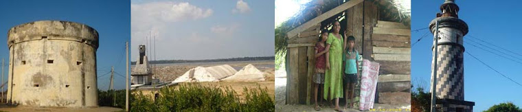
Hambantota, in Sri Lanka' dry zone, is best-known for its beautiful Crescent-shaped bay and its slat flats that line the main road for over 16 km – an ago old industry that still thrives today.

Legend has it the archaic name of Hambantota appears to have been Sampanthurai. This word Sampan is said to have been derived from the Malay word meaning navigators, as the Malays, in the olden days were sea-farers who had come in their sailing vessels for barter trade. The word 'Thurai' means a port - a Tamil derivation. Another version, In the legends, ‘Hamban’ is popularly known as an ethnic group called ‘Malay’ or ‘Muslims’ and ‘thota’ means where those groups were landed. During British rule, Hambantota became an importantdistrict. The colonial rulers had left their indelible marks on Hambantota.


Boundary

Boundary of the District

To the North-West of the District is bounded by hills called Panilkanda, Gongala, Kabaragala, Koppakanda and Bissogala which extends from the foothills of the Buluthota ranges, on its Western boundary are found hills called Nagalakanda, Kotihena, Kerakele, Ambangala and Deniyakanda on the North and North-East it is surrounded by Kataragama Hills. While the Kumbukkan Oya and the Indian Ocean is found from its Eastern and Southern Boundaries.


Location

Location

Hambantota District which is situated in the South-East of Sri Lanka occupies 2625.50 square Kms in area. The maximum length of the District is 106 KM. It extends from Ritigala in the West to Kumana in the East. The maximum width of the District is 39 KMs. It extends from Hingurakanda in the North to Welladdoragoda in the South. Just over 29.8 Square KM of the District is covered by major inland water bodies.

Hambantota, the main city of Hambantota District is located near the 148th mile (238-km) post along the Colombo-Galle-Matara-Tissamaharama Road.

As regards the size, Hambantota District receives the 12th place from among the 25 Administrative Districts of Sri Lanka.

North, North Western : Rathnapura District

North East : Moneragala District

West : Matara District

South east : Ampara District

South : Indian Ocean

You might also like